
History of the Route: Leith Wynd
Extract from William Edgar’s 1742 Plan of the City and Castle of Edinburgh
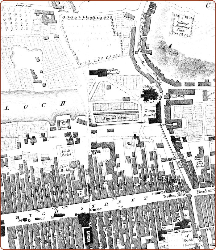
The beginning: Leith Wynd
Before the draining of the Nor Loch and the development of the New Town, the primary route from Edinburgh to Leith was to exit the burgh via the eastern Nether Bow Gate and turn left down Leith Wynd. You can see Leith Wynd on the right side of the map below, just north of the Nether Bow. This led to Calton Road, noted on the map below as ‘The Western Road to Leith,’ which proceeded down to Leith roughly along the route of the current Leith Walk. There were no routes from Edinburgh to Leith further west as the Nor Loch prevented crossing from Edinburgh to the land that was to become the New Town.
On Edgar’s 1742 map below, generally agreed to be the first accurate scale map of Edinburgh, you can see that St Mary’s Street (St Mary’s Wynd in 1742), the High Street, and the Canongate are all in the same place as they are today. Calton Road roughly follows the same route as today though it was moved slightly to be closer to the crags during Waverley’s redevelopment in the 1890s.
You can also see Trinity College Hospital & Church (including the Orphan Hospital) which was demolished, along with its physic garden, and partially moved when the original Waverley Station was built in the 1840s.
